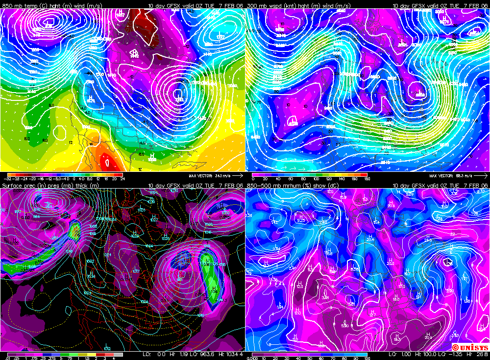
 The title of this post is in honor of my old buddy Joe Thomas. Joe and I worked in Montana together. I was always looking for the next snow storm and during dry periods, I may have to look way out into the future sometimes even to day 10. I would say it knowing that far out on ANY computer model can't be taken literally. The above is no exception. Even though the model can't be accepted for the details, the OVERALL idea with this map is an evolution to a colder pattern. Huge rigde is going up in western Canada. The configuration sends a trough downstream. The ridge can tap into some incredible cold air and send it south. That's what I think will happen the week of Feb. 5th. Temperatures in Alaska have ranged from 50-60 degrees below zero. While we won't be that cold. The serious cold air will plunge south and winter will return . Enjoy this next week of mild temperatures and low energy costs while it lasts.

Saturday, January 28, 2006
Did You See Day 10?
The title of this post is in honor of my old buddy Joe Thomas. Joe and I worked in Montana together. I was always looking for the next snow storm and during dry periods, I may have to look way out into the future sometimes even to day 10. I would say it knowing that far out on ANY computer model can't be taken literally. The above is no exception. Even though the model can't be accepted for the details, the OVERALL idea with this map is an evolution to a colder pattern. Huge rigde is going up in western Canada. The configuration sends a trough downstream. The ridge can tap into some incredible cold air and send it south. That's what I think will happen the week of Feb. 5th. Temperatures in Alaska have ranged from 50-60 degrees below zero. While we won't be that cold. The serious cold air will plunge south and winter will return . Enjoy this next week of mild temperatures and low energy costs while it lasts.
Subscribe to:
Post Comments (Atom)

-
FOLLOW ON FACEBOOK: TODD YAKOUBIAN TWITTER: KATV_WEATHER I'll have more on Arkansas Weather in a new post soon, but I wanted to as...
-
 You think it's cold right now? While we're all shivering in the middle of this arctic blast, it's nothing compared to what happ...
 -
 Is time running out on Arkansas? Did you know it has been 84 years since Arkansas has experienced an F5 tornado? According to the National...
No comments:
Post a Comment