Sorry I haven't been blogging since last week. It's time to get back into the swing of things as we get another round of rain and maybe a few storms.
I'm not expecting an outbreak, but strong storms will be possible and a few severe storms can't be ruled out late Tuesday. Right now, I think we'll see a good bit of rain Tuesday afternoon, then the chance for some thunderstorm activity will increase as well. I think it's best to target the southern half of the state for a slightly elevated risk for severe weather. If strong to severe thunderstorms do develop, the main threat will be high winds and some hail. The threat for tornadoes can never be ruled out, but at this time, that threat is not all that high.
Check out the maps below.
 |
| The high res. WRF model indicates the moisture levels to support any significant severe weather will remain across the south half. When looking for severe, 55 degree dew points and higher are really needed. This shows 60 degree dew points nosing into central sections with lesser amounts the further north you go. This map is valid at 9 PM Tuesday |
|
|
 |
| Now let's talk about CAPE... instability. The highest levels of surface based CAPE will remain confined to the south half of the state. This is the NAM and it's valid at 3AM Tuesday. |
 |
| The Storm Prediction Center has a slight risk for severe weather across much of the state with a hatched area of 30% probabilities for severe weather across the south half of the state. |
 |
| Significant amounts of rainfall will also be possible. Above is the NAM showing around 1'' or more across a good chunk of Arkansas. |
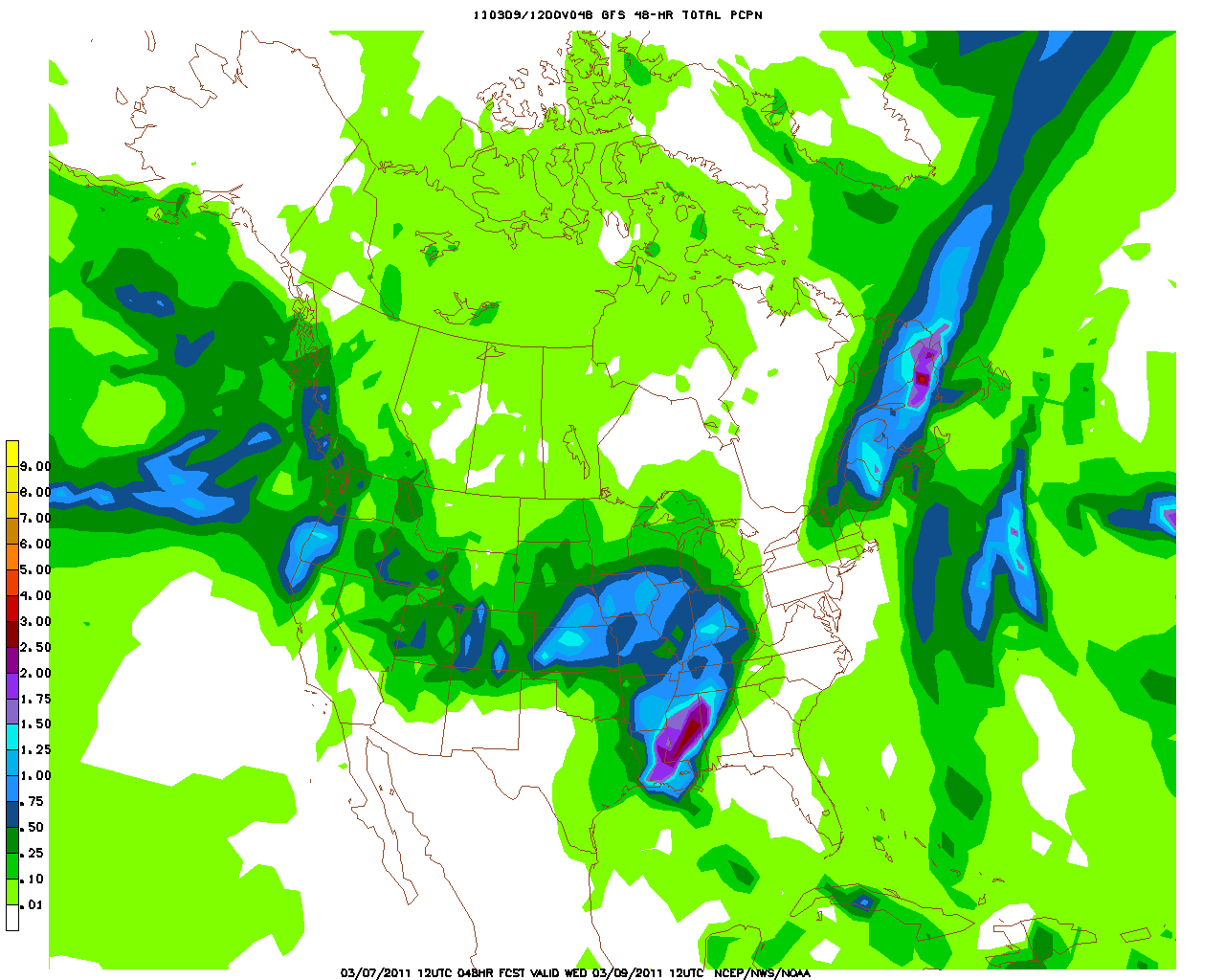
 |
| This is the GFS showing a good chance for significant rainfall as well. |


No comments:
Post a Comment