Monday, December 17, 2012
A Christmas Day Storm System?
1:40 PM Monday Update... First thing, I can't thank all of you enough for getting your weather information here on the Arkansas Weather Blog. This marks 6 years I have been doing this and I love seeing the numbers grow and grow. It just confirms my belief you love the weather as much as I do.
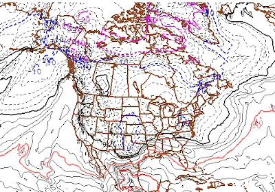
Now onto what the computers are saying and what I believe. If you get a chance, make sure your read the original blog post today. It does look like a storm system will influence Arkansas weather Christmas Day and on the 26th. While I show you the specific model information, take it with a grain of salt. This far out in the forecast, it's going to be wrong! However, I want to show you the things we look at when making forecasts so you know what we're watching and the possibilities that exist down the road. With that said, here's an update from the European model run this morning.
___________________________________________________________________
You will see Let's get ready to ruuummmmmmbbbbbbbllllleeeeee. We actually have something to watch Christmas week! Before you get too excited, this storm has been on the computer models for awhile and they all show mostly rain. HOWEVER, let's dream okay? We can do this because the overnight run of the European model does show something interesting happening late Christmas Day here in Arkansas, but the GFS is just a rain maker.
Remember, take these computer models with a grain of salt! If you recall, last week I showed you data which pointed to snow in portions of northern Arkansas on Tuesday morning and that was completely wrong. So getting these models to accurately predict a storm more than a week away is absolutely impossible, but like I said, let's dream. It will be interesting to follow this as we go into Christmas week.
So what should you take from this? The models have been hinting at a system around Christmas time and as you would expect, the models vary greatly on how this will play out. Remember, the purpose of this blog is not to make official Channel 7 forecasts, but to show you the things we are looking at in the weather center.
I have seen the models show storms in the long range and then days later, it's gone and nothing happens. Let's just stay patient and see what happens. I'll keep you updated!
Subscribe to:
Post Comments (Atom)
-
FOLLOW ON FACEBOOK: TODD YAKOUBIAN TWITTER: KATV_WEATHER I'll have more on Arkansas Weather in a new post soon, but I wanted to as...
-
You think it's cold right now? While we're all shivering in the middle of this arctic blast, it's nothing compared to what happ...
-
Is time running out on Arkansas? Did you know it has been 84 years since Arkansas has experienced an F5 tornado? According to the National...


1 comment:
Hey Todd and fellow bloggers.....
Glad to see you finally coming around to my idea of a possible Christmas present that I mentioned a few posts ago! The models continue to suggest a trend to a much stormier and colder pattern beginning next week. The models are continuing to do their normal waffling but are definitely trending in the right direction for snow / cold lovers. It appears from my amateur's vantage point that as the PNA transitions to a more positive state later this month that will allow for the cold in NW Canada to finally come southward. In addition it looks like the NAO is going to remain negative, (slightly) which should give us some shots of some winter-like weather.
I would love to hear SnowBirdBob's and Ninja's take on this as well as yours.
Post a Comment