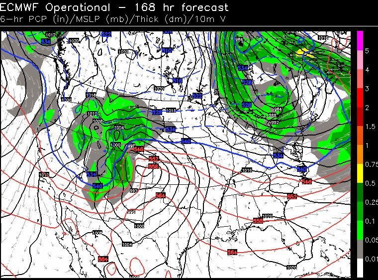
If you're dreaming of a white Christmas, keep dreaming. Now that we are within the 7 day window, confidence is growing we will NOT have snow flying or on the ground Christmas Day here or anywhere around Arkansas. I will say this... the models have been a little erratic lately and I will always leave that wiggle room to say things could change, but you can't deny what that data has said and is saying today (Friday). In the world of weather, there is NEVER a situation with 100% confidence until after it happens. You'll get burned at some point.
We're going to get a strong cold front in here late Monday with a quick shot of cold air. This air mass does not have arctic characteristics so I'm not expecting a drastic cool down. It moves in and out rapidly. The operational GFS and European indicates we'll be between system Christmas Day with temperatures above average. As a matter of fact, if you believe the data this morning, we could have highs in the 60s. Again, I'll leave a little "wiggle room" since this is a forecast out to 7 days. There will be a cold front moving in by Friday. What if it gets here faster? The last week of the month still looks chilly with a good chance for below average temperatures.
 | ||
| And here is the operational GFS showing a very similar set-up, but not as strong with that wave of low pressure over Colorado. |


No comments:
Post a Comment