
The only way out of it for southeast Texas is a faster movement away from that area, but that chance appears small at this point.
Now, what about Arkansas? If you follow on Twitter and Facebook, I have been adamant in saying if Harvey impacts Arkansas, it won't be until the middle of next week. I still believe that. I know many of you want a forecast that's set in stone right now, but that's absolutely impossible with a system like this 5-7 days away.
I'm not going to claim I know much about agriculture, but I'm sure farmers are watching this forecast. With the upcoming harvest, heavy rainfall could be an issue. Also, the home opener for the Razorbacks is in Little Rock next Thursday and this storm could affect the game.
After several days of meandering around southeast Texas, Harvey could make a move towards the northeast. The morning runs of the GFS and the Euro both show an impact on Arkansas between Wednesday and Friday of next week. Just because the models show it this morning, does not mean it will happen. There will likely be a lot of variance between all the model runs for awhile, then a solution will emerge we can have some confidence in. When will that happen? Probably later in the weekend.
 |
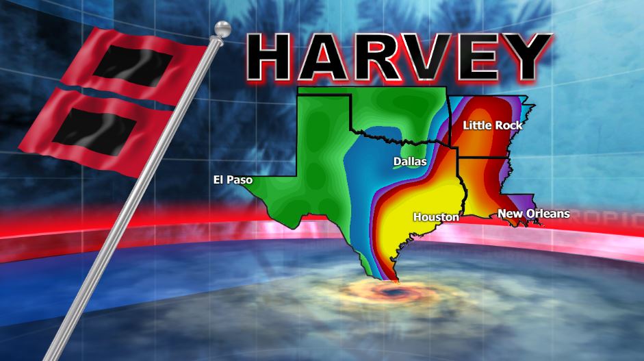
| The GFS valid next Thursday has the center of Harvey over northeast Texas. The position of the center is crucial to our forecast. Remember, it's along and east of that center that has the greatest potential for rainfall and some of that could be heavy. |
 |
| The Euro has Harvey in northern Louisiana next Thursday. This track would also have an impact on Arkansas. |
 |
| I can't stress this enough. This will change. However, the 20'' or more across southeast Texas appears likely. Further north, the amounts are completely dependent upon the track and we won't have a firm grasp of that for a couple more days at least. |


No comments:
Post a Comment