
It was Super Tuesday and many were voting in the presidential primary. You may remember former Arkansas Governor Mike Huckabee was on the ballot. We had our station satellite truck at his campaign headquarters that evening. Ned, Barry, and I were on the air tracking a classic supercell moving northeast ahead of a squall line of thunderstorms. That super cell put down an EF4 tornado and it stayed on the ground for a record breaking 122 miles. Before it hit Clinton, I walked up to our news director and told him we needed crews to head to Clinton and the town was about to sustain major damage. That's when he called the crew with the satellite truck and we abandoned primary coverage. They immediately went to Clinton. As the squall line finally made it to Little Rock, we recorded an official 67mph wind gust which still stands as the 6th highest wind gust ever recorded at the Little Rock airport and the highest for the month of February.
 |
| These series of radar images show the base reflectivity on the left and the velocities on the right. The hook echo is plain as day and the couplet is very strong on the velocity panel as it hit Atkins. |
 |
| The tornado moved just south of Scotland and was taking aim on Clinton. This is when I told our news director Clinton was in deep trouble and would likely sustain major damage. |
 |
| The tornado hitting Clinton |
 |
| The tornado began to take aim on Mountain View |
 |
| Mountain View getting hit and it was rated EF4 here. |
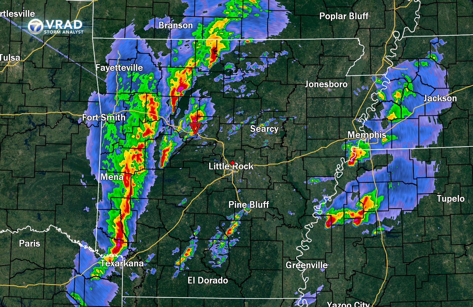 |
| It was a classic set up with cells ahead of a squall line. Anytime this happens, the cells in front are able to get out on their own and spin. |
 |
| The squall line moving into central Arkansas with record wind gusts. |
 |
| From Dusty Norris. The tornado as it hit Atkins. |
 |
| As the tornado left Atkins and moved northeast. |
 |
| Mountain View sustained EF4 damage. |
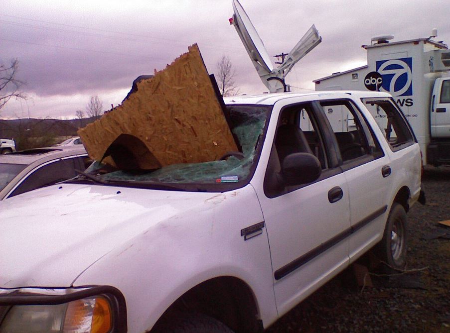 |
| Windows blown out of this car and huge piece of wood slicing through the windshield. This is 1 of the many reasons why you should never be in a car during a tornado |
 |
| I took this picture in Atkins the next day. |
 |
| There were several other smaller tornadoes that day as well and most of the state was in a "High risk" for severe weather. |
 |
| The severe weather outlook that day from the Storm Prediction Center. It was a rare, high risk day for much of the state. |


No comments:
Post a Comment