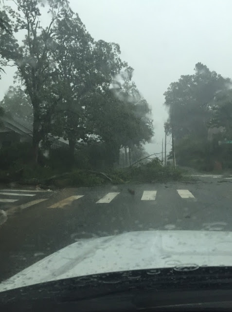
Little Rock was hit hard and at one point, more than 9 thousand lost electricity across the state according to Entergy. There were a few trees blown over and plenty of lightning to disrupt power.
Rainfall amounts varied greatly. At my house in west Little Rock, I only received .51'' of an inch. The Little Rock airport received .97'', and the North Little Rock airport received 2.26'' of rain and that broke the old daily rainfall record of 1.13'' set in 2007. It's very important to remember, records at North Little Rock only date back to the 1970s compared to the 1870s in Little Rock.
As storms started to bubble up into the atmosphere early this afternoon, they generated numerous outflow boundaries. These are cool rushes of air that descend from a thunderstorm, hits the ground, and spreads out in all directions. This creates miniature cold fronts. If one passes your location, you typically feel a gust of wind around 20-35mph and temperatures fall a bit. These outflow boundaries can be the focal point for additional thunderstorm development, especially if two of them intersect. That's exactly what happened over the Little Rock metro this Sunday afternoon. If you watched my Facebook LIVE video (It's still available on my page) you will see my explanation of that and my worry that would develop big storms.
One of the benefits to this rainfall will be felt this week as a ridge of high pressure builds into the region. As long as the soil has water in it, the suns energy will go into evaporation and not entirely into heating the surface. This will prevent many places from seeing an actual air temperature of 100 degrees. HOWEVER, with all the humidity around, the heat index will likely exceed 100 degrees and may get close to 105 which is heat advisory criteria.
I CAN NEVER THANK ALL OF YOU ENOUGH FOR YOUR HELP COVERING SEVERE WEATHER. YOU SEND ME RAINFALL AMOUNTS, SKY CONDITIONS, VIDEO, PICTURES, ETC. YOUR DEDICATION, LOYALTY, AND FRIENDSHIP MEANS A LOT TO ME!
Thanks to Terry on Twitter for sending in the video below. He was on Mount Nebo this Sunday afternoon and recorded a downburst off in the distance over Lake Dardanelle. You can clearly see the rain and air descending on the left side of the screen. Notice how it hits the ground and spreads out. There are times this can create winds in excess of 60 mph and causes a lot of damage.
Here's radar imagery of the outflow boundaries colliding over the metro and the thunderstorms increasing.
 |
| One of many trees down. This is in Hillcrest and sent in from Mark Young. |
 |
| Massive tree fell over in Monticello during a thunderstorm. Picture sent in from Michael Douglas. |


No comments:
Post a Comment