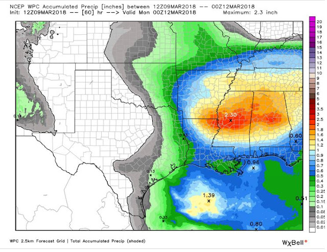
One other key factor will be what happens in the Gulf of Mexico. There could be quite a bit of storm development over the waters and that would help blunt the higher moisture values from surging north. Nevertheless, enough instability will be present to pose a small chance for strong to severe storms mainly across southern Arkansas. The main risks will be hail, lightning, and heavy rainfall. Since it is March, you can never rule out a tornado, but that chance is very low.
We should see a few morning showers and storms and then another round later in the day. That round will pose the low chance for a strong/severe storm.
Late Sunday, we'll have a strong disturbance fly in from the north. At this time, colder air will be in place with windy conditions. While the upper level conditions look favorable for some wintry weather, this time of year it's crucial to keep an eye on surface temperatures. With that said, I still think it's possible for a few wet snowflakes to fly across northern Arkansas later Sunday into Sunday night. At this time, it does not look like a biggie. It's just one of those things that makes you go "WOW!"... if it even happens.
 |
| Severe risk south Arkansas Saturday |
 |
| Severe weather impacts... hail and flooding will be the main concern. It's March, so you can never rule out a tornado threat, but it looks rather low. |
 |
| Rainfall amounts should be around 1-2'' southern and eastern Arkansas. |
 |
| The NAM Sunday night/Monday morning, the NAM, along with other models, shows a few wet snowflakes falling across far northern Arkansas. This will be most likely across the higher elevations. |


No comments:
Post a Comment