
As I always tell you, anything in the long range can and will change. This is a classic example. The timing of this system keeps speeding up and I expect most of the rain and storm activity Saturday night into Sunday morning. The severe threat with this system still exists, but not the degree it looked like a few days ago. The worst of this will be east and north of Arkansas, BUT, it still must be watched.
We're also on record watch this weekend. Temperatures Sunday could challenge daily record highs. That record is 92 years old (81 degrees set in 1921). Winds will also be an issue this weekend. They will be strong and out of the south Saturday, then out of the southwest and west Sunday. Then the cold front moves through and brings us back to reality Monday. At one time it looked like the air mass behind this next front could be colder than earlier this week. The models have backed off on that and readings will be closer to average.
Most of these maps below come from weatherbell.com and show the Euro. Remember, with each of these maps, the precipitation amounts apply to the previous 6 hours. The black lines, isobars, depict the surface analysis by the Euro at that particular time.
 |
| The Euro shows some hefty rainfall amounts from midnight to 6AM Sunday. Some storms could be strong at this time. |
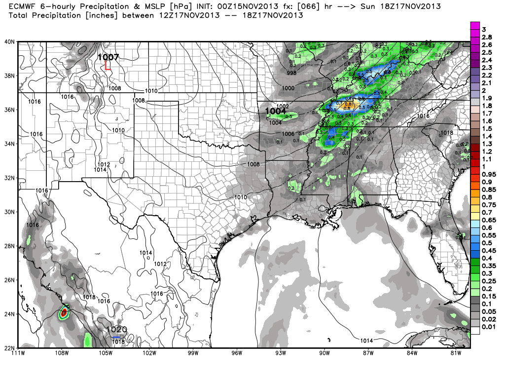 |
| From 6AM to Noon, the Euro shows lighter amounts with the heaviest east of the state. See the isobars bending over MO into OK? That's the cold front. So as of noon Sunday, it's still west. We will have to watch the development ahead of the front throughout the day, especially eastern AR for any severe storms. Ahead of the front, it will be windy and warm with temperatures near 80! |
 |
| By 6PM, the front is entering central AR with most of the precip from noon to 6PM east and south of Little Rock. |
 |
| From the Storm Prediction Center, the green area shows where general thunderstorm activity is likely. Some of these storms will be strong, but the severe chance is quite low at this time. A "slight risk" extends from eastern AR up to the Great Lakes. |
 |
| The yellow area means there is a 15% chance for severe weather within 25 miles of any given location. The red area means there is a 30% chance for severe weather within 25 miles of any given location. |


No comments:
Post a Comment